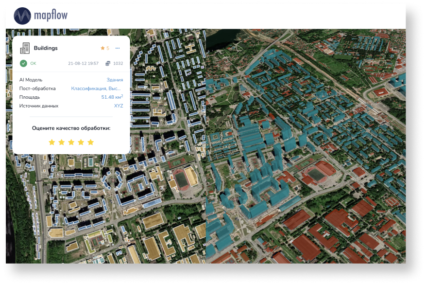
Urban Mapping
Urban Mapping provides ready-to-use datasets extracted and updated using recent satellite imagery. We’ve built the active learning framework for AI models to transfer and apply our technology to new urban structures and tune models in less time. Our coverage includes built-up areas in Russia, Western and South Africa, Middle East and Central Asia.
We enrich building footprints (Level of Details 01) with height estimates predicted direclty by AI or measured by buildings shadows and walls in oblique imagery.
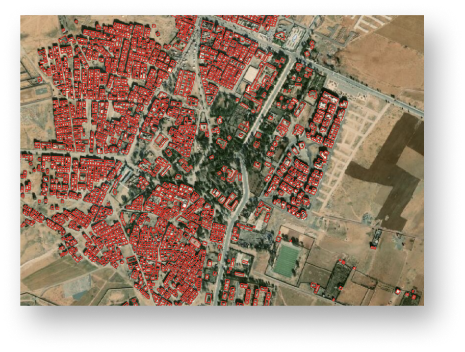
Building footprints: active learning
Active learning workflow is applied to transfer our technology to new construction domains. It enables to reduce time for imagery labelling while iteratively increasing the accuracy of the algorithms
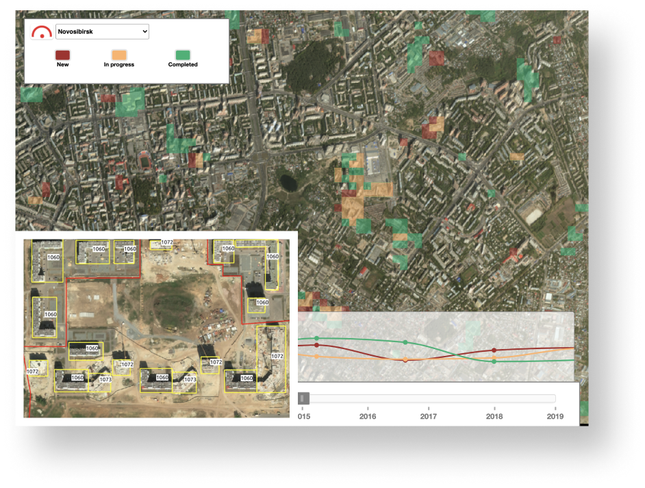
Building & Construction
Images taken from satellites provides historical information and cover larger areas that laverages your analytics workflow with data and context. “Construction Detection tool allows to subscribe for a specific sites or for a whole city area to monitor construction dynamics and get updates at the particular spot and all around. It is considered to be the fastest and the most cost-effective way to detect overall construction progress for land management, mitigation of financial risks, forecasting of the demand services
Population density maps
Countrywide datasets of detailed urban infrastructure are the basic product for creation of population density maps to be implemented into analytical workflows from disasters risk assessment to identification of the best locations for the new stores and services. At the implementation phase our clients use Mapflow buildings detection algorithms to create or update the datasets of distribution of the population proportionately to the capacity of buildings in the hogh-resolution spatial grid cell.

Russia
Building footprints
27M